Scheduled Downtime
On Friday 21 April 2023 @ 5pm MT, this website will be down for maintenance and expected to return online the morning of 24 April 2023 at the latest

Error in Multi-scale Kain-Fritsch scheme

This post was from a previous version of the WRF&MPAS-A Support Forum. New replies have been disabled and if you have follow up questions related to this post, then please start a new thread from the forum home page.

jahokson

New member
Hi I'm using WRF 4.2 and I can't seem to make Multi-scale Kain-Fritsch (MSKF) scheme work when it is not used for all domains (2 domains for my case). I'm using the same settings for my other simulations and all are successful except the one using MSKF (scheme 11). It worked for cu_physics=0,1,2,3,&10. My domains are 15 km and 5 km, and the smaller domain is always set to cu_physics=0.

I have this error from rsl.error.0002 when cu_physics= 11, 0,

WRF TILE 1 IS 1 IE 74 JS 75 JE 148
WRF NUMBER OF TILES = 1
Tile Strategy is not specified. Assuming 1D-Y
WRF TILE 1 IS 1 IE 101 JS 112 JE 223
WRF NUMBER OF TILES = 1
xland is not 1. or 2., run stopped
-------------- FATAL CALLED ---------------
FATAL CALLED FROM FILE: <stdin> LINE: 4191
xland is not 1. or 2., run stopped
-------------------------------------------

Does it mean that WRF requires that all domains should be cu_physics = 11 when using MSKF?
Thank you.
 
Please send me your namelist.wps and namelist.input to take a look.
By the way, do you run with standard WRFv4.2?
 
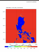
Hi! I'm running 4.2.1. Please see attached file (also script below). Thank you very much

-------namelist.wps----------
&share
wrf_core = 'ARW',
max_dom = 2,
start_date = '2015-10-15_00:00:00','2015-10-15_00:00:00'
end_date = '2015-10-21_06:00:00','2015-10-21_06:00:00'
interval_seconds = 21600,
io_form_geogrid = 2,
/

&geogrid
parent_id = 1, 1,
parent_grid_ratio = 1, 3,
i_parent_start = 1, 15,
j_parent_start = 1, 44,
e_we = 148, 202,
e_sn = 148, 223,
!
!!!!!!!!!!!!!!!!!!!!!!!!!!!! IMPORTANT NOTE !!!!!!!!!!!!!!!!!!!!!!!!!!!!
! The default datasets used to produce the MAXSNOALB and ALBEDO12M
! fields have changed in WPS v4.0. These fields are now interpolated
! from MODIS-based datasets.
!
! To match the output given by the default namelist.wps in WPS v3.9.1,
! the following setting for geog_data_res may be used:
!
! geog_data_res = 'maxsnowalb_ncep+albedo_ncep+default', 'maxsnowalb_ncep+albedo_ncep+default',
! geog_data_res= 'nlcd2011_9s+default',
!!!!!!!!!!!!!!!!!!!!!!!!!!!! IMPORTANT NOTE !!!!!!!!!!!!!!!!!!!!!!!!!!!!
!
geog_data_res = 'default','default',
dx = 15000,
dy = 15000,
map_proj = 'mercator',
ref_lat = 15.0,
ref_lon = 125.0,
truelat1 = 15.0,
!truelat2 = 60.0,
stand_lon = 125.0,
geog_data_path = '/workm/Jose/WRF_build/WPS_GEOG_V4/V4/'
/

&ungrib
out_format = 'WPS',
prefix = 'FILE',
/

&metgrid
fg_name = 'FILE'
io_form_metgrid = 2,
/


----namelist.input---------
&time_control
run_days = 6,
run_hours = 6,
run_minutes = 0,
run_seconds = 0,
start_year = 2015, 2015,
start_month = 10, 10,
start_day = 15, 15,
start_hour = 0, 0,
end_year = 2015, 2015,
end_month = 10, 10,
end_day = 21, 21,
end_hour = 6, 6,
interval_seconds = 21600
input_from_file = .true.,.true.,
history_interval = 60, 60,
frames_per_outfile = 1000, 1000,
restart = .false.,
restart_interval = 21600,
io_form_history = 2
io_form_restart = 2
io_form_input = 2
io_form_boundary = 2
/

&domains
time_step = 90,
time_step_fract_num = 0,
time_step_fract_den = 1,
max_dom = 2,
e_we = 148, 202,
e_sn = 148, 223,
e_vert = 35, 35,
p_top_requested = 4500,
num_metgrid_levels = 27,
num_metgrid_soil_levels = 4,
dx = 15000,
dy = 15000,
grid_id = 1, 2,
parent_id = 0, 1,
i_parent_start = 1, 15,
j_parent_start = 1, 44,
parent_grid_ratio = 1, 3,
parent_time_step_ratio = 1, 3,
feedback = 1,
auto_levels_opt = 2,
!dzstretch_s = 1.3,
!dzbot
smooth_option = 0
use_adaptive_time_step = .true.,
/

&physics
mp_physics = 7, 7,
cu_physics = 11, 0,
ra_lw_physics = 1, 1,
ra_sw_physics = 1, 1,
bl_pbl_physics = 7, 7,
sf_sfclay_physics = 1, 1,
sf_surface_physics = 2, 2,
radt = 15, 15,
bldt = 0, 0,
cudt = 0, 0,
icloud = 1,
!num_land_cat = 24,
sf_urban_physics = 0, 0,
/

&fdda
/

&dynamics
hybrid_opt = 2,
w_damping = 0,
diff_opt = 1, 1,
km_opt = 4, 4,
diff_6th_opt = 0, 0,
diff_6th_factor = 0.12, 0.12,
base_temp = 290.
damp_opt = 3,
zdamp = 5000., 5000.,
dampcoef = 0.2, 0.2,
khdif = 0, 0,
kvdif = 0, 0,
non_hydrostatic = .true., .true.,
moist_adv_opt = 1, 1,
scalar_adv_opt = 1, 1,
gwd_opt = 1, 1,
/

&bdy_control
spec_bdy_width = 5,
specified = .true.
/

&grib2
/

&namelist_quilt
nio_tasks_per_group = 0,
nio_groups = 1,
/
 

Attachments

  • namelist.input
    3.7 KB · Views: 41
  • namelist.wps
    1.4 KB · Views: 36
I run a 2-way nesting case using your physics option. The model run successfully. I am suspicious that this is not a problem arising from physics. Can you double check your input data, especially wrfinput-d02? Note that the error message indicates xland is neither 1 nor 2, which might be the reason why your case failed.
 
Thank you for your reply.
Sorry, but can you explain more? (What is xland? and how can I check input?)

I have tried re-running ./real exe and also steps for WPS several times, but still the same (still the same error).

I'm using GFS data and it works with other namelist.input.
Only this cumulus scheme combination doesn't work: cu_physics = 11, 0,.
 
XLAND is a variable in wrfinput and wrfout. It should be 2 at water points and 1 at land points. If xland is not 1 or 2, it indicates that the landmark might be wrong. Such errors can trace back to WPS (mainly metgrid).
Can you look at your wrfinput_d02 and wrfout_d02 files, and see whether xland is correct?
 
Here's the XLAND at time=0. Same figure for wrfinput_d02 and wrfout_d02... .
Thanks
 

Attachments

  • Screen Shot 2020-12-30 at 10.28.48.png
    Screen Shot 2020-12-30 at 10.28.48.png
    251.5 KB · Views: 1,164
The value of xland should be 1 or 2. In the figure you sent, I notice some areas of yellow color. Can you check the value of xland in these areas? or please upload your file for me to take a look.
If xland value is wrong in certain area of your model domain, it indicates that somehow the landmark between WRF and your input data are not consistent and something is wrong in horizontal interpolation. In this case, we will re-examine ungrib and metgrid.
 
Here are the files. Thank you very much
 

Attachments

  • met_em.d01.2015-10-15_00%3A00%3A00.nc
    26.8 MB · Views: 35
  • wrfout_d02_2015-10-15_00%3A00%3A00.nc
    176.3 MB · Views: 35
  • wrfinput_d02.nc
    140.7 MB · Views: 36
This problem is arising from the Goddard 4-ice scheme. It is not an issue in MSKF.
xland in your input file looks fine, which indicates that the there is no problem in WPS. Looking into the details of the code, it is obvious that something is wrong in WRF-CHEM, which leads to this error message that is actually not the 'true' reason for the failure.
Please post your message to WRF-CHEM forum. People in NOAA who are responsible for the WRF-CHEM will be able to help you.
 
Thank you very much for all your replies and effort. Will proceed as advised.
Wishing you a prosperous 2021.
 
Top