FLUIDDYNAMICS2
New member
Greetings,
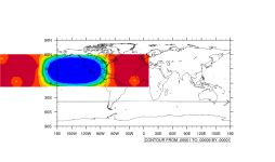
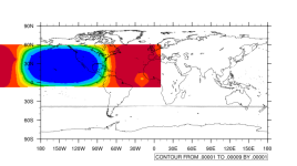
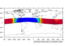
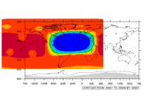
I am trying to create a high resolution domain that extends east of Africa and to the Gulf of Mexico. So fair I used two tools MPAS-TOOLS and MPAS-Limted-area to generate a mesh .nc file. I wanted to know what does the blue color mean for the .nc files I created using the .create_region in the MPAS-Limted-area tool using the points channel tropics with coordinates ulat: 35.43, llat: -35.43, ulon: 0.0, and llon: 80.0.
Thanks,
Travis