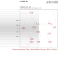
I am making a forecast for northern Argentina. I attached the namelist.wps, but when I want to draw any ncl example I get that the latitudes and longitudes are wrong. I tried with an old file from the previous configuration and the ncl script works fine and in this the coordinates are wrong. How can I solve it? I attach an image with the coordinates that appear in the png.
I use WRF v4.6.1
Thank you so much
I use WRF v4.6.1
Thank you so much

