Scheduled Downtime
On Friday 21 April 2023 @ 5pm MT, this website will be down for maintenance and expected to return online the morning of 24 April 2023 at the latest

Issue with Land Use Out-of-Range Error and RSMAS Topography Dependency in Three-Nested-Domain WRF Simulation

likai

New member
Dear all,

I am trying to run a high-resolution simulation with three nested domains, but I have encountered the following issues:

  1. The model fails with a fatal error related to land use:


    -------------- FATAL CALLED ---------------
    FATAL CALLED FROM FILE: <stdin> LINE: 1833
    ERROR: LANDUSE OUTSIDE RANGE = 99706 AT 10 1 LUN= 61
    -------------------------------------------
  2. Additionally, during initialization, the model repeatedly prints warnings about the RSMAS Topo Ingest Code:


    ***************************************************************
    Access to RSMAS Topo Ingest Code is by Special Arrangement Only
    in WRF. Please contact wrfhelp@ucar.edu.
    ***************************************************************
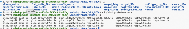
    This suggests that the simulation is attempting (and failing) to access RSMAS terrain data.
Attached are my namelist.input, namelist.wps, and configure.wrf files for your reference.

Any advice on resolving the land use out-of-range error and accessing the RSMAS data error would be greatly appreciated!

Best regards,

Kai Li
 

Attachments

  • namelist.input
    4.6 KB · Views: 1
  • namelist.wps
    1.1 KB · Views: 1
  • rsl.error.0000
    12.4 KB · Views: 1
  • configure.wrf.txt
    21.2 KB · Views: 0
Last edited:
Can you change the options in namelist.wps as follows:

stand_lon = 123.5

geog_data_res = 'default', 'default', 'default'

Then rerun geogrid.exe and metgrid.exe.
 
Can you change the options in namelist.wps as follows:

stand_lon = 123.5

geog_data_res = 'default', 'default', 'default'

Then rerun geogrid.exe and metgrid.exe.
I attempted to modify the namelist.wps file by setting:
stand_lon = 123.5
and then re-ran geogrid.exe and metgrid.exe. However, the simulation still failed with the same error.

The reason I did not initially change geog_data_res to 'default', 'default', 'default' is that, according to the WRF User Guide (Section 5.5: Moving Nest), when using high-resolution terrain and land-use data from RSMAS (as required for moving nests), geog_data_res must be set to 'usgs_30s+default'. This is because the RSMAS high-resolution dataset is based on USGS 30-second data, not the standard default datasets.

The RSMAS data I’m using were obtained from:
WRF Model - Moving Nest

For reference, I’ve also attached my RSMAS/ directory structure and the WPS_GEOG/ directory.

Interestingly, if I explicitly disable the high-resolution input by setting:
rsmas_data_path = "/mindopt/Data/rsmas",
input_from_hires = .false., .false., .false.,
the model runs successfully—though, of course, without the high-resolution terrain and land-use benefits intended for the moving nest.
 

Attachments

  • 截屏2025-12-04 08.58.15.png
    截屏2025-12-04 08.58.15.png
    516.9 KB · Views: 1
Top