Hello.
I am seeking clarification regarding the difference between "latitude" (with latitude dimension) and "latCell" (with 'latitude, longitude' dimension) in the latlon.nc fie, generated by 'convert_mpas'.
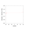
I am currently remapping my 60-3 km variable mesh output to a 0.1-degree lat-lon grid using convert_mpas. I have plotted the difference between these two variables, calculated as latitude ( : ) - latCell ( : , 0 ) *180.0/(atan(1)*4.0), and the difference is approximately 0.02 degrees near the poles. (Please see the attached plot.) While this might not have a significant impact in most cases, could you please let me know why they differ and which variable would be more suitable?
Thank you,
Jihyeon

