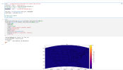
In my 3-km regional MPAS run over the CONUS, I get reasonable values for basic variables like MSLP, height_500hpa, surface temperature and humidity that look close to observations for that day. I'm using ERA5 for initial and boundary conditions. But the derived fields like refl10cm_max, cape, cin, lcl, etc. are all zero for the full 2 hours I'm testing.
I also can't find any documentation as to how CAPE and associated parcel variables are calculated (.i.e. surface-based, most unstable).
I'm attached my streams and namelist files here. Thanks!
Elisa
I also can't find any documentation as to how CAPE and associated parcel variables are calculated (.i.e. surface-based, most unstable).
I'm attached my streams and namelist files here. Thanks!
Elisa

