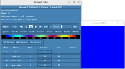
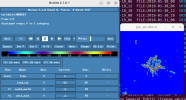
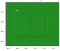
Hello I am trying to set a domain using LCZ + Default. I want to use WRF urban for a city. As per the instructions the minimum domain size should be 100 * 100 and I set up accordingly. But, when I use ncview geo_em.d03.nc, it shows completely null value for 3d variable landusef , is it not supposed to show the land category from CGLS?. In the picture attached below I have selcted land_cat as 53, since LCZ is represented from 51 to 61. Is it only visible after implementation of (use_wudapt_lcz=1).??
I have attached the picture.
&geogrid
parent_id = 1, 1, 2,
parent_grid_ratio = 1, 3, 5,
i_parent_start = 1, 108, 148,
j_parent_start = 1, 137, 144,
e_we = 318, 319, 101,
e_sn = 367, 247, 101,
geog_data_res = 'cglc_modis_lcz+default','cglc_modis_lcz+default','cglc_modis_lcz+default',
dx = 2000,
dy = 2000,
map_proj = 'lambert',
ref_lat = 27.00,
ref_lon = 85.321,
truelat1 = 28.150,
truelat2 = 28.150,
stand_lon = 85.321,
geog_data_path = '/home/bdipson/WRF/WPS-4.5/NEW_GEOG/WPS_GEOG_HIGH_RES/',
/
I doubt my parameters are wrong for geogrid, I tried to make the innermost domain atlest 100*100 thats why I had to choose 2km resolution for outer-domain , in such way I can crop only the city in my innermost domain for analysis. Also How old is the static data for Albedo12M, greenfrac while using geog_data res='cglc_modis_lcz + default'?
Attachments
Last edited:


