Dear Colleges,
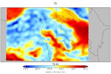
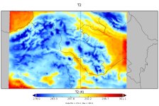
The assimilation of satellite radiance consistently produces colder temperatures and convective precipitation decrease in my wrf forecasts!
I am trying use satellite radiance and humidity in my convective-permitting simulations. I have experimented a lot with different background options (CV3, CV5, CV7), length scale, variance, thinning, VARBC options, etc. I have applied satellite data assimilation to the first guess field derived from both wrf initial condition fields (wrfinput) and WRF forecasted fields (wrfout).
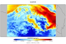
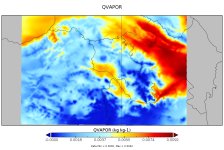
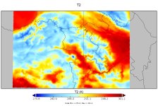
After data assimilation there is a well-defined tendency of temperature decrease and reducing precipitation amounts over my simulation domains for all cases. These data assimilation effects are becoming more and more enhanced when I use cycling data assimilation and assimilate satellite data more than once (e.g. at 00, 06, 12 UTC).
For some cases disappearing of the precipitation areas are 'good', since over the mountain areas the WRF simulates false (spurious) convective precipitations. However, 'correctly' simulated areas also disappear after data assimilation. For example, the local heavy rainfall area of interest successfully simulated by the WRF model disappears after data assimilation.
I am attaching my namelist file. Is anything wrong with it? Can you explain the reasons for this issue?
Best regards,
Artur

