bruceyoung01
Member
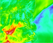
I am running WRF-Chem 3.9 with NEI2011 emission over the eastern US with spatial resolution of 3 km by 3 km. When I plot the output of surface O3 mixing ratio, the field looks like one grid by grid, not continuous between grids. Please see the attached plot. Do you have any thoughts on this? For 4 km by 4 km spatial resolution, there is no this. I do not think it's related to the setup of namelist. Thank you

