You are using an out of date browser. It may not display this or other websites correctly.
You should upgrade or use an alternative browser.
You should upgrade or use an alternative browser.
wrf run error
- Thread starter deva_wrf
- Start date
the program terminate after some time
===================================================================================
= BAD TERMINATION OF ONE OF YOUR APPLICATION PROCESSES
= EXIT CODE: 1
= CLEANING UP REMAINING PROCESSES
= YOU CAN IGNORE THE BELOW CLEANUP MESSAGES
===================================================================================
===================================================================================
= BAD TERMINATION OF ONE OF YOUR APPLICATION PROCESSES
= EXIT CODE: 1
= CLEANING UP REMAINING PROCESSES
= YOU CAN IGNORE THE BELOW CLEANUP MESSAGES
===================================================================================
This is a standard output in rsl.error.0000 that doesn't really hep. Did you look at all the rsl files? There should have some other error messages that provide more information, i.e., when, where and what is wrong in this case?
By the way. did this case crash immediately? Or the case run for a while before it crashed?
By the way. did this case crash immediately? Or the case run for a while before it crashed?
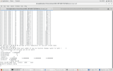
please responseimmediately crashesView attachment 8332
This error message shows clearly that landmarks and soil type are inconsistent at the grid point (47, 82). landmarks indicates this is a water point, but soil type indicates this is a land point.
For ERA5 data, you need to download not only the upper air and soil data, but also need to get the invariant land-sea mask dara. Please see the attached file that describes how to download ERA5.
For ERA5 data, you need to download not only the upper air and soil data, but also need to get the invariant land-sea mask dara. Please see the attached file that describes how to download ERA5.

