Hi all,
this is my first post in forum and I'm glad I found this community, since I found here really a lot of good solutions when starting with WRF. However, I ran into a small problem when integrating new albedo data and I could not find out what I'm doing wrong. Maybe it is just something trivial I'm missing out, but I could not find any solution, so I'm looking for help or guidance on how to solve this problem.
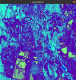
I want to use my own albedo data derived from Landsat 7 imagery, which I processed into binary and successfully ran geogrid. I viewed the result and prepared data were fine, however, after running real, the albedo values in wrfinput are zero. I also set the namelist to use usemonalb = .true. and enabled sst_update. I'm currently running WRF4.0 paired with qgis to prepare, accommodate and test new data for microscale simulations, so the parameterisation is yet basic (maybe I'm missing something here, but according to the manual it seems that all settings should work fine). Other new data like elevation and land cover were working fine.
Adding namelist and albedo from geogrid to the attachments.
Thanks in advance.

