Scheduled Downtime
On Friday 21 April 2023 @ 5pm MT, this website will be down for maintenance and expected to return online the morning of 24 April 2023 at the latest

CFL errors when using SST update

This post was from a previous version of the WRF&MPAS-A Support Forum. New replies have been disabled and if you have follow up questions related to this post, then please start a new thread from the forum home page.

kaelel18

Member
Hi, WRF Team. I am running a simulation which uses sst update since my simulation will run for more than a week. Previously, I was able to run the simulation, without sst update, just fine. But with sst update, the simulation becomes unstable and runs cfl error.s Looking at the location of the vertical cfl errors, it was located in the ocean, hence I surmised that it might be because of the SST. In one forum I read that if the location is in the ocean, it might be the input has strangely warm waters causing vertical velocities.

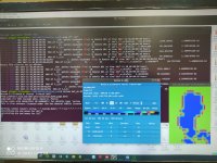
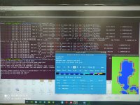
I got the sst data from noaa-avhrr, sea surface temperature optimum interpolation. I tried reducing the timestep and increasing epssm, but to no avail. I am attaching the namelist and rslerrors for reference. Thanks
 

Attachments

  • rslerror.tar.gz
    340 KB · Views: 46
  • namelist.input
    5.5 KB · Views: 52
Hi,
Have you taken a look at the SST values in the location of the CFL errors to see if they look abnormal?
 
Hi kwerner. Yeah, I checked the SST values. I am not sure though if the values are abnormal, although at one location the value is around 383K. I am attaching two snapshots of the location of the sst errors.
 

Attachments

  • cfl eror1.jpg
    cfl eror1.jpg
    776.6 KB · Views: 1,163
  • cfl error2.jpg
    cfl error2.jpg
    459.4 KB · Views: 1,163
Yeah, those values don't look correct. The range for SST in that window is
-1228.92 to 552.338 K
which is impossible. Can you attach the following files so that I can take a look:
namelist.wps
Vtable.SST that you used for the SST data
1-2 of your SST input files (prior to running ungrib)
Thanks!
 
Hi kwerner. I am attaching the files asked. I am also attaching my metgrid tbl. I noticed that when I changed the interpolation method for the SST, the values changes. For example, when I use nearest_neighbor, the values shows in the image below, where -999 refers to land. Thanks

Capture.JPG
 

Attachments

  • avhrr-only-v2.20171229.nc
    1.6 MB · Views: 52
  • avhrr-only-v2.20171230.nc
    1.6 MB · Views: 46
  • namelist.wps
    1.8 KB · Views: 45
  • Vtable.gfs.txt
    6.4 KB · Views: 47
  • METGRID.TBL
    34.1 KB · Views: 51
Hi,
The SST data you sent are in NetCDF format. Did you convert those to intermediate format to be used in the metgrid program? If so, can you send me the converted files? Thanks.
 
Hi kwerner,

Attached it SST data in intermediate format. Thanks!
 

Attachments

  • SST-2017-12-.zip
    3.1 MB · Views: 49
Hi,
Thanks for sending that. I think the problem may have something to do with the fact that you have LANDSEA included in your SST files. I notice that the "bad" values for SST are all over land. I was looking at some of my pre-made SST intermediate files and they do not have any discrepancies between land and ocean. The SST values are just continuous across the globe. Perhaps you wanted to use a different landsea, but can you try to put that in a separate file from the SST file and see if that makes any difference?
 
Top