jordanschnell
Member
THE BELOW POST HAS BEEN RESOLVED
THE PROBLEM WAS THAT "GEOG_DATA_RES" needed to be defined for both domains.
Hi,
I am attempting to create a nested domain configuration such that the child domain has the same resolution as the parent domain. The reason for wanting to do this is that I have multiple input data sources and other pre-compiled programs that use additional ancillary data that are set up to run on the parent domain, but I need to conduct some simulations on a smaller domain. My idea was to create the necessary files for the parent domain and then just use ncks to cut out the portion of the domain that I need. The problem is that upon creating the domains, they do not seem to overlap exactly:
For example, here is the &geogrid portion of namelist.wps:
&geogrid
parent_id = 1, 1,
parent_grid_ratio = 1, 1,
i_parent_start = 1, 321,
j_parent_start = 1, 177,
e_we = 954, 405,
e_sn = 835, 265,
geog_data_res = 'modis_lakes',
dx = 0.1218330000000000000,
dy = 0.1218330000000000000,
map_proj = 'lat-lon',
pole_lat = 36.0
pole_lon = 180.
stand_lon = 106.0
ref_lat = 54.0
ref_lon = -106.0,
Then, if I cut the LANDMASK field from the smaller domain (note that ncks uses 0-based indexing):
ncks -v LANDMASK -d south_north,176,439 -d west_east,320,723 geo_em.d01.nc landmask_cut_from_full.nc
ncks -v LANDMASK geo_em.d02.nc landmask_cut_from_small.nc
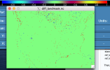
And compare it to the LANDMASK from the smaller domain, I find that they are not identical:
ncdiff landmask_cut_from_full.nc landmask_cut_from_small.nc diff_landmask.nc
Given the +1/-1 locations, it does not simply look like a shift in one or both directions (i.e., I would assume alternating +1/-1 at boundaries).
I appreciate the advice.
Best,
Jordan

Last edited:
