Hourly output mismtach between WRF and ERA5

samudra

Member
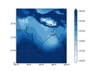
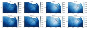
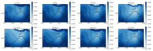
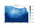
Hi, I compared the wrf output with ERA5 dataset but found that some hours have a different spatial pattern (here, geopotential at 850hPa). I am attaching the namelist.input and rsl.error.0000 files along with the difference in spatial pattern at a particular timestep. Note that the distinction is not every time but in between some hours, which i believe is random. Upon averaging daily or 3 hourly, the variation is spatial pattern vanishes. Kindly suggest whether there is some namelist file changes to be made, or the runs are correct. [era5:- z_hr_39.png, wrf:- d1new_hr_39.png].
Secondly, do the wrf model typically have some sort of wet bias over oceans?
 

Attachments

  • rsl.error (2).0000
    rsl.error (2).0000
    2.3 MB · Views: 1
  • namelist (5).input
    namelist (5).input
    4.3 KB · Views: 2
  • d1new_hr_39.png
    d1new_hr_39.png
    34.8 KB · Views: 1
  • z_hr_39.png
    z_hr_39.png
    48.2 KB · Views: 1
  • geop_3hravgd_wrf.png
    geop_3hravgd_wrf.png
    170.2 KB · Views: 1
  • geop_3hravgd_era5.png
    geop_3hravgd_era5.png
    173.5 KB · Views: 1
Hi, I believe what you're seeing is correct. The fact that it all evens out with averaging should mean that the overall pattern is similar. Plus, we expect some differences between the ERA5 input data and the WRF output due to resolution differences and the various physics options used during WRF.
 
I was planning to extract the track of the specific MD using geopotential at 850 (shown above) in an hourly resolution. Now, while using the wrfout files, it gives an inconsistent track because of that. Probably would have to average out or generate a 3 hourly track for my case. Thanks for the reply.
 
Back
Top