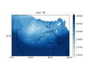
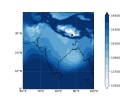
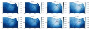
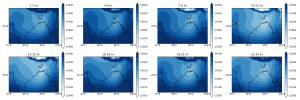
Hi, I compared the wrf output with ERA5 dataset but found that some hours have a different spatial pattern (here, geopotential at 850hPa). I am attaching the namelist.input and rsl.error.0000 files along with the difference in spatial pattern at a particular timestep. Note that the distinction is not every time but in between some hours, which i believe is random. Upon averaging daily or 3 hourly, the variation is spatial pattern vanishes. Kindly suggest whether there is some namelist file changes to be made, or the runs are correct. [era5:- z_hr_39.png, wrf:- d1new_hr_39.png].
Secondly, do the wrf model typically have some sort of wet bias over oceans?
Secondly, do the wrf model typically have some sort of wet bias over oceans?