Hi all,
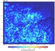
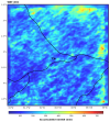
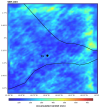
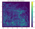
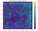
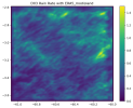
While simulating over the Amazon rainforest, using three nested domains initializing with ERA5 reanalysis data, the inner domains show huge accumulated precipitation along the north-east boundary region (as shown in attached images). What could be the reasons behind this? Any help will be greatly appreciated.
Thank you.