Hi, I am running WRF v4.2.2 using ERA5 data for initial and boundary conditions over Great Lakes region. My spatial resolution is 4km. In the wrflowinp_d01, I noticed the SST over Great Lakes are blocky, not well covers the lakes along the shoreline. This affects the WRF output in all the variables because for those grid cells (at 4km) that should be influenced by the lakes (through the surface temperature), they were not. I am attaching figures overlapping the SST data from wrflowinp_d01 with USGS Shapefiles over the five lakes respectively.
So I went back looking at geo_em.d01.nc and met_em.d01* file. I found the SST in met_em.d01 files are the same in wrflowinp. I also noticed in both files there is a variable 'LANDMASK', which shows high resolution lakes and well covers the water bodies; there is 'LANDSEA' in met_em.d01 file, which is blocky and seems from the ERA5, according to this lines in METGRID.TBL:
name=LANDSEA
interp_option=nearest_neighbor
fill_missing=-1.
fill_lev=200100:LANDMASK(1)
this LANDSEA file covers more grid cells over lakes than the SST data. I am attaching these 3 variables (LANDMASK, LANDSEA, SST).
My question is, when we run wrf.exe, is there any interpolation/extrapolation for the grid cells (from ERA5's resolution to 4km) that are over lakes according to the landmasks, but there is no SST (all zeros)? Is LANDSEA being used for WRF or LANDMASK? There are many such grid cells if LANDMASK is used, even LANDSEA is used there are still such grid cells. If there is some interpolation going on along the shoreline of the lakes, then at least we will have some SST values (instead of zeros), they may not accurate because it may be extrapolated from the nearest ocean grid.
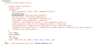
I am attaching my namelist.wps (WPS4.2) and namelist.input. Please note that I do not use any lake model. Can you please take a look and see I should change anything to make it more reasonable? Thank you!
So I went back looking at geo_em.d01.nc and met_em.d01* file. I found the SST in met_em.d01 files are the same in wrflowinp. I also noticed in both files there is a variable 'LANDMASK', which shows high resolution lakes and well covers the water bodies; there is 'LANDSEA' in met_em.d01 file, which is blocky and seems from the ERA5, according to this lines in METGRID.TBL:
name=LANDSEA
interp_option=nearest_neighbor
fill_missing=-1.
fill_lev=200100:LANDMASK(1)
this LANDSEA file covers more grid cells over lakes than the SST data. I am attaching these 3 variables (LANDMASK, LANDSEA, SST).
My question is, when we run wrf.exe, is there any interpolation/extrapolation for the grid cells (from ERA5's resolution to 4km) that are over lakes according to the landmasks, but there is no SST (all zeros)? Is LANDSEA being used for WRF or LANDMASK? There are many such grid cells if LANDMASK is used, even LANDSEA is used there are still such grid cells. If there is some interpolation going on along the shoreline of the lakes, then at least we will have some SST values (instead of zeros), they may not accurate because it may be extrapolated from the nearest ocean grid.
I am attaching my namelist.wps (WPS4.2) and namelist.input. Please note that I do not use any lake model. Can you please take a look and see I should change anything to make it more reasonable? Thank you!