
Hello,
I am running a 5 year simulation for a region in Northeast Brazil. I'm using FNL 0.25deg as inicial and boundary data and ERA5 for SST updates and using spectral nudging for the coarse domain. I've set 2 domains, 9 and 3 km resolution. All the other options in namelist.input are pretty much usual. I took lots of tips from other posts here. I did change SST lines on METGRID.TBL following https://dreambooker.site/2017/12/20/Initializing-the-WRF-model-with-ECMWF-ERA-Interim-reanalysis/ because I was getting the error "grid%tsk unreasonable" while running ./real - and it solved.
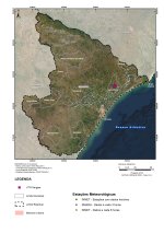
I've simulated about 3 months so far, and as I was comparing some data with observation at two points within the finer domain, I got very good results in one of them (Poço Verde) and bad results in the other (Brejo Grande). Any ideas why? I'm not an experienced modeller, so I'm wondering wether I can actually improve my results. My goal is to obtain reliable data for another point (Japaratuba).
I do not believe changing parameterizations would improve significantly my results.
I attached my domains, terrain plot, weather stations over a map, namelists (.wps and .input) and plots for T and TD for the 2 stations.
I appreciate any insight, solutions or ideas.
I am running a 5 year simulation for a region in Northeast Brazil. I'm using FNL 0.25deg as inicial and boundary data and ERA5 for SST updates and using spectral nudging for the coarse domain. I've set 2 domains, 9 and 3 km resolution. All the other options in namelist.input are pretty much usual. I took lots of tips from other posts here. I did change SST lines on METGRID.TBL following https://dreambooker.site/2017/12/20/Initializing-the-WRF-model-with-ECMWF-ERA-Interim-reanalysis/ because I was getting the error "grid%tsk unreasonable" while running ./real - and it solved.
I've simulated about 3 months so far, and as I was comparing some data with observation at two points within the finer domain, I got very good results in one of them (Poço Verde) and bad results in the other (Brejo Grande). Any ideas why? I'm not an experienced modeller, so I'm wondering wether I can actually improve my results. My goal is to obtain reliable data for another point (Japaratuba).
I do not believe changing parameterizations would improve significantly my results.
I attached my domains, terrain plot, weather stations over a map, namelists (.wps and .input) and plots for T and TD for the 2 stations.
I appreciate any insight, solutions or ideas.
Attachments
-
namelist.input4.8 KB · Views: 40
-
namelist_ERA5.wps1.5 KB · Views: 32
-
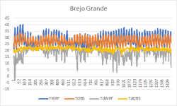 T_Td_BrejoGrande.png28.7 KB · Views: 947
 -
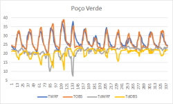 T_Td_PocoVerde.png26.4 KB · Views: 948
 -
wps_show_dom.pdf45.5 KB · Views: 34
-
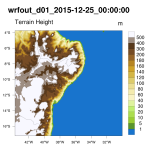 wrf_gsn_TerrenoD01.png138.4 KB · Views: 948
 -
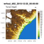 wrf_gsn_TerrenoD02.png133.6 KB · Views: 948
 -
 Weather_stations.jpg2.2 MB · Views: 947