Hey guys,
I'm trying to simulate the jet-stream in the subtropical regions, (West 120°-60° / South 5°-55°) over 10 days.
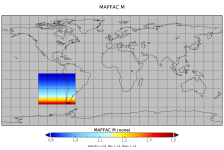
Currently I am using mercator as my map-projection, which is easy to use, but I have been told that my max map factor ( = 1.47 ) may be a little bit too high.
Would you consider 1.47 too much?
please finde the attached mapfactor from my geo_em file.
What would you recommend?
This is the geogrid section of my namelist.wps:
&geogrid
parent_id = 1,
parent_grid_ratio = 1,
i_parent_start = 1,
j_parent_start = 1,
e_we = 188,
e_sn = 193,
geog_data_res = 'default',
dx = 30000,
dy = 30000,
map_proj = 'mercator',
ref_lat = -34.0,
ref_lon = -90.0,
truelat1 = -34.0,
truelat2 = -34.0,
stand_lon = 0.090,
Thanks for any advice.
Cheers
Torben

