Dear WRF community,
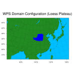
I am wondering whether there is a way to overlay shapefile for study area using WRF domain wizard? In this sense, I can check whether the inner domain covers the entire study area.
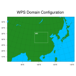
Further, the tool (plotgrids_new.ncl) provides a way to plot all the domains. However, it seems difficult to overlay a polygon/polyline through gsn_add_* functions. (the frames for the most inner domain will be removed) As indicated in attached figures, D02 frame disappeared when adding polygon.
Thanks,
LSL


