Hello there,
There is information in the old forum, a bit ambiguous, and I can't get results by applying that procedure to correctly process SRTM data in geogrid. I would like that together we can provide a standard methodology to do this.
I tell you my procedure and at the point where I am, where the result has failed.
1) I have downloaded the data from ->
http://dwtkns.com/srtm/
http://srtm.csi.cgiar.org/wp-content/uploads/files/srtm_5x5/TIFF/srtm_33_07.zip
2) I have compiled the "convert_geotiff" package from ->
https://github.com/openwfm/convert_geotiff
3) And these are the instructions that I have used ->
./convert_geotiff -w 4 -t 6000 -u “meters MSL” -d “Topography height” sourceSRTM.tif
3.1) When I execute the previous command, it tells me that "Too many positional arguments", then i do ->
./convert_geotiff -w 4 -t 6000 sourceSRTM.tif
It seems to end correctly and generates an index file (attached) and another files 0001xxxx. I modify by hand the fields of "units" and "description" of index file.
4) I continue to modify ->
/geogrid/GEOGRID.TBL.ARW
interp_option= 3s: average_gcell(4.0)+four_pt+average_4pt
rel_path= 3s: topo_3s
namelist.wps -> geog_data_res = “3s”
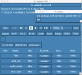
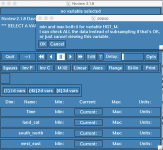
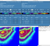
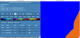
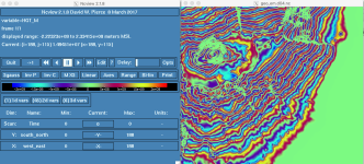
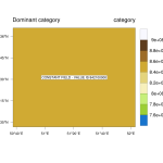
5) And I run geogrid.exe, it ends without failure, but when I open the domain (to verify)->
(min and max both 32768 for variable HGT_M)
Have I done something wrong, any suggestions?..
index file ->
Code:
projection = regular_ll
known_x = 1
known_y = 6000
known_lat = 30.000000
known_lon = -20.000000
dx = 0.00833333
dy = 0.00833333
type = continuous
signed = yes
units = "meters MSL"
description = "Topography height"
wordsize = 4
tile_x = 6000
tile_y = 6000
tile_z = 1
tile_bdr = 3
missing_value = 0.000000
scale_factor = 1.000000
row_order = bottom_top
endian = little
