Scheduled Downtime
On Friday 21 April 2023 @ 5pm MT, this website will be down for maintenance and expected to return online the morning of 24 April 2023 at the latest

troubles, could not find trapping x locations

This post was from a previous version of the WRF&MPAS-A Support Forum. New replies have been disabled and if you have follow up questions related to this post, then please start a new thread from the forum home page.

martina

New member
Hello everyone,

I'm trying to run WRF with ERA5 data, but I'm running into problems because the surface log pressure is only available on one level (which is level 1 at the top of the model). Ungrib, calc_ecmf_p and metgrid run without problems, but when I run the real.exe the error message I get is "troubles, could not find x locations." which is related to the missing zlog p. I've checked the rsl.out and from what I can tell it indeed is missing the pressure on the different levels because it is filled with NAN. I've already tried to change the metgrid.tbl to tell WRF that it should interpolate, but frankly with only one level there is not much to interpolate with... and it didn't solve the issue so I've deleted these lines again.

This is an excerpt from the rsl.out
column of pressure and value = NaN 0.3898096
column of pressure and value = 1.8249277E-04 0.3898096
.....................................................................

And here are the warnings I get when I run the calc_ecmwf_p:
WARNING No available level found near level 136 !
WARNING No available level found near level 135 !
WARNING No available level found near level 134 !
...
WARNING No available level found near level 4 !
WARNING No available level found near level 3 !
WARNING No available level found near level 2 !
Reading from ALL_ML at time 2006-08-15_06
Found SOILHGT field in ALL_ML:2006-08-15_06
Found PSFC field in ALL_ML:2006-08-15_06
Found SOILHGT field in ALL_ML:2006-08-15_06
..........
I've attached the Vtable for ERA5 that I've created.

There is no way that I will get more than one level of zlog pressure from ERA5 so I'm at a loss as to what I can do here and I appreciate any help very much.

Thank you!
Martina
 

Attachments

  • Vtable.ERA5.txt
    3.9 KB · Views: 64
Martina,

Likely the problem is introduced by the inconsistency between the Vtable and the data during the ungrib step.

To check out the output from the ungrib program, use the WPS/util/rd_intermediate.exe program.

Here is what a single level of a single field at a single time looks like:
Code:
> util/rd_intermediate.exe FILE:2018-06-07_12 > foo.txt
> head -13 foo.txt
================================================
FIELD = PMSL
UNITS = Pa DESCRIPTION = Sea-level Pressure
DATE = 2018-06-07_12:00:00 FCST = 0.000000
SOURCE = NCEP GFS Analysis       GRID   4
LEVEL = 201300.000000
I,J DIMS = 720, 361
IPROJ = 0  PROJECTION = LAT LON
  REF_X, REF_Y = 1.000000, 1.000000
  REF_LAT, REF_LON = 90.000000, 0.000000
  DLAT, DLON = -0.500000, 0.500000
  EARTH_RADIUS = 6371.229492
DATA(1,1)=101350.695312

Here is a list of ALL of the vertical coordinate values (this one is isobaric):
Code:
> util/rd_intermediate.exe FILE:2018-06-07_12 | grep LEVEL | sort -u | sort -k 3n
LEVEL = 100.000000
LEVEL = 200.000000
LEVEL = 300.000000
LEVEL = 500.000000
LEVEL = 700.000000
LEVEL = 1000.000000
LEVEL = 2000.000000
LEVEL = 3000.000000
LEVEL = 5000.000000
LEVEL = 7000.000000
LEVEL = 10000.000000
LEVEL = 15000.000000
LEVEL = 20000.000000
LEVEL = 25000.000000
LEVEL = 30000.000000
LEVEL = 35000.000000
LEVEL = 40000.000000
LEVEL = 45000.000000
LEVEL = 50000.000000
LEVEL = 55000.000000
LEVEL = 60000.000000
LEVEL = 65000.000000
LEVEL = 70000.000000
LEVEL = 75000.000000
LEVEL = 80000.000000
LEVEL = 85000.000000
LEVEL = 90000.000000
LEVEL = 92500.000000
LEVEL = 95000.000000
LEVEL = 97500.000000
LEVEL = 100000.000000
LEVEL = 200100.000000
LEVEL = 201300.000000

Here is a list of fields that I have:
Code:
> grep FIELD foo.txt | sort -u
FIELD = GHT
FIELD = HGTMAXW
FIELD = HGTTROP
FIELD = LANDSEA
FIELD = PMAXW
FIELD = PMAXWNN
FIELD = PMSL
FIELD = PSFC
FIELD = PTROP
FIELD = PTROPNN
FIELD = RH
FIELD = SEAICE
FIELD = SKINTEMP
FIELD = SM000010
FIELD = SM010040
FIELD = SM040100
FIELD = SM100200
FIELD = SNOW
FIELD = SNOWH
FIELD = SOILHGT
FIELD = ST000010
FIELD = ST010040
FIELD = ST040100
FIELD = ST100200
FIELD = TMAXW
FIELD = TT
FIELD = TTROP
FIELD = UMAXW
FIELD = UTROP
FIELD = UU
FIELD = VMAXW
FIELD = VTROP
FIELD = VV

The ERA5 data will need to have a pressure array listed if it is NOT isobaric.

If the output from the ungrib program is OK, we can look at the metgrid output.

The metgrid output has 3d data for a number of fields: the horizontal components of wind, a moisture field (typically relative humidity, but others are OK), a thermal field (usually temperature), a height field, a pressure field, and possibly a few others.

I have a local metgrid file. The ncdump command shows the following 3d fields:

Code:
> ncdump -h met_em.d01.2020-04-19_00:00:00.nc | grep south | grep east | grep num_
	float PRES(Time, num_metgrid_levels, south_north, west_east) ;
	float SOIL_LEVELS(Time, num_soilt_levels, south_north, west_east) ;
	float SOILT(Time, num_soilt_levels, south_north, west_east) ;
	float SOILM(Time, num_soilm_levels, south_north, west_east) ;
	float QNIFA(Time, num_qnwfa_levels, south_north, west_east) ;
	float QNWFA(Time, num_qnwfa_levels, south_north, west_east) ;
	float QNI(Time, num_metgrid_levels, south_north, west_east) ;
	float QNC(Time, num_metgrid_levels, south_north, west_east) ;
	float QNR(Time, num_metgrid_levels, south_north, west_east) ;
	float QG(Time, num_metgrid_levels, south_north, west_east) ;
	float QS(Time, num_metgrid_levels, south_north, west_east) ;
	float QI(Time, num_metgrid_levels, south_north, west_east) ;
	float QR(Time, num_metgrid_levels, south_north, west_east) ;
	float QC(Time, num_metgrid_levels, south_north, west_east) ;
	float PRESSURE(Time, num_metgrid_levels, south_north, west_east) ;
	float GHT(Time, num_metgrid_levels, south_north, west_east) ;
	float RH(Time, num_metgrid_levels, south_north, west_east) ;
	float VV(Time, num_metgrid_levels, south_north_stag, west_east) ;
	float UU(Time, num_metgrid_levels, south_north, west_east_stag) ;
	float SPECHUMD(Time, num_metgrid_levels, south_north, west_east) ;
	float TT(Time, num_metgrid_levels, south_north, west_east) ;

Note that there is a PRES and a PRESSURE array.

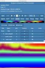
Here is a cross section of the PRES field.

Screen Shot 2020-06-18 at 10.53.26 AM.png

What do your files show?
 
Martina,
I am specifically interested in the list of the vertical coordinate values. Would you please post this information? It will tell us your data is on pressure level or on model level. Thanks.
 
Thank you for your answers. I'll check the ungrib output and let you know.
@ Ming Chen: I use the ERA5 on model levels (137 levels)
 
Hi Dave,

so I ran the intermediate.exe and here is the output:

[*================================================
FIELD = PMSL
UNITS = Pa DESCRIPTION = Sea-level Pressure
DATE = 2006-08-13_12:00:00 FCST = 0.000000
SOURCE = ECMWF
LEVEL = 200100.000000
I,J DIMS = 181, 181
IPROJ = 0 PROJECTION = LAT LON
REF_X, REF_Y = 1.000000, 1.000000
REF_LAT, REF_LON = 35.000000, -20.000000
DLAT, DLON = -0.250000, 0.250000
EARTH_RADIUS = 6367.470215
DATA(1,1)=101816.750000


[ util/rd_intermediate.exe ML\:2006-08-13_12 | grep LEVEL | sort -u | sort -k 3n
LEVEL = 1.000000
LEVEL = 2.000000
LEVEL = 3.000000
LEVEL = 4.000000
LEVEL = 5.000000
LEVEL = 6.000000
LEVEL = 7.000000
LEVEL = 8.000000
LEVEL = 9.000000
LEVEL = 10.000000
LEVEL = 11.000000
LEVEL = 12.000000
LEVEL = 13.000000
LEVEL = 14.000000
LEVEL = 15.000000
LEVEL = 16.000000
LEVEL = 17.000000
LEVEL = 18.000000
LEVEL = 19.000000
LEVEL = 20.000000
LEVEL = 21.000000
LEVEL = 22.000000
LEVEL = 23.000000
LEVEL = 24.000000
LEVEL = 25.000000
LEVEL = 26.000000
LEVEL = 27.000000
LEVEL = 28.000000
LEVEL = 29.000000
LEVEL = 30.000000
LEVEL = 31.000000
LEVEL = 32.000000
LEVEL = 33.000000
LEVEL = 34.000000
LEVEL = 35.000000
LEVEL = 36.000000
LEVEL = 37.000000
LEVEL = 38.000000
LEVEL = 39.000000
LEVEL = 40.000000
LEVEL = 41.000000
LEVEL = 42.000000
LEVEL = 43.000000
LEVEL = 44.000000
LEVEL = 45.000000
LEVEL = 46.000000
LEVEL = 47.000000
LEVEL = 48.000000
LEVEL = 49.000000
LEVEL = 50.000000
LEVEL = 51.000000
LEVEL = 52.000000
LEVEL = 53.000000
LEVEL = 54.000000
LEVEL = 55.000000
LEVEL = 56.000000
LEVEL = 57.000000
LEVEL = 58.000000
LEVEL = 59.000000
LEVEL = 60.000000
LEVEL = 61.000000
LEVEL = 62.000000
LEVEL = 63.000000
LEVEL = 64.000000
LEVEL = 65.000000
LEVEL = 66.000000
LEVEL = 67.000000
LEVEL = 68.000000
LEVEL = 69.000000
LEVEL = 70.000000
LEVEL = 71.000000
LEVEL = 72.000000
LEVEL = 73.000000
LEVEL = 74.000000
LEVEL = 75.000000
LEVEL = 76.000000
LEVEL = 77.000000
LEVEL = 78.000000
LEVEL = 79.000000
LEVEL = 80.000000
LEVEL = 81.000000
LEVEL = 82.000000
LEVEL = 83.000000
LEVEL = 84.000000
LEVEL = 85.000000
LEVEL = 86.000000
LEVEL = 87.000000
LEVEL = 88.000000
LEVEL = 89.000000
LEVEL = 90.000000
LEVEL = 91.000000
LEVEL = 92.000000
LEVEL = 93.000000
LEVEL = 94.000000
LEVEL = 95.000000
LEVEL = 96.000000
LEVEL = 97.000000
LEVEL = 98.000000
LEVEL = 99.000000
LEVEL = 100.000000
LEVEL = 101.000000
LEVEL = 102.000000
LEVEL = 103.000000
LEVEL = 104.000000
LEVEL = 105.000000
LEVEL = 106.000000
LEVEL = 107.000000
LEVEL = 108.000000
LEVEL = 109.000000
LEVEL = 110.000000
LEVEL = 111.000000
LEVEL = 112.000000
LEVEL = 113.000000
LEVEL = 114.000000
LEVEL = 115.000000
LEVEL = 116.000000
LEVEL = 117.000000
LEVEL = 118.000000
LEVEL = 119.000000
LEVEL = 120.000000
LEVEL = 121.000000
LEVEL = 122.000000
LEVEL = 123.000000
LEVEL = 124.000000
LEVEL = 125.000000
LEVEL = 126.000000
LEVEL = 127.000000
LEVEL = 128.000000
LEVEL = 129.000000
LEVEL = 130.000000
LEVEL = 131.000000
LEVEL = 132.000000
LEVEL = 133.000000
LEVEL = 134.000000
LEVEL = 135.000000
LEVEL = 136.000000
LEVEL = 137.000000]


And those are the fields that I fount in the SFC file:
FIELD = DEWPT
FIELD = PMSL
FIELD = PSFC
FIELD = RH
FIELD = SEAICE
FIELD = SKINTEMP
FIELD = SM000007
FIELD = SM007028
FIELD = SM028100
FIELD = SM100255
FIELD = SNOW
FIELD = SST
FIELD = ST000007
FIELD = ST007028
FIELD = ST028100
FIELD = ST100255
FIELD = TT
FIELD = UU
FIELD = VV

I have the impression that my list of fields is much shorter that yours...
What would you think?
Martina
 
Hi Ming,

thank you for working on this issue and letting me know! Please let me know once you have a solution.

Martina
 
Top