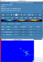
I'm using land cover data for parts of Ontario that has impervious fraction built in, and I want to use it since the included nlcd file only has data for the US. However, I'm having trouble -- the geo_em files show reasonable values of frc_urb2d in the US but no values (all 0) in Canada.
I followed the directions in the WRF user's guide to create this. hexdump shows that the binary file was correctly written (not all 0, and is of the correct size. As a test, I changed fill_missing to 1 in GEOGRID.TBL for diagnostic purposes -- the geo_em files were now all 1.
To test further, I changed the name of the file and saw that I got the same result, and geogrid didn't so much as throw a warning. Therefore, I suspect that geogrid is not reading in the binary file at all. Why might this be? I'm sure I named it correctly (00001-48233.00001-35255). Is it because of its size (1.7 GB)?
Attached are the index and GEOGRID.TBL files.
Thanks in advance for your help!

