Qianqian Huang
New member
Hi,
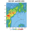
I noticed that there are VAR and VAR_SSO in geo_em*.nc file. May I ask, what's the difference between those two?
The description of VAR is "stdev of subgrid-scale orographic height", and the description of VAR_SSO is "Variance of Subgrid Scale Orography". So except that one is stdev and the other is variance, is there any other difference? I have calculated that VAR is not equal to sqrt(VAR_SSO).
Thanks in advance.
Qianqian

