rabbanidu93
Member
Dear altruists,
For the domain between 45S to 55N and 23W and 174E, while trying to display the
variables in GrADS i got the following error:
Operation error: Invalid dimension environment
Min longitude > max longitude: 353.454 157.426
In Grads,
"
ga-> open test.ctl
Scanning description file: test.ctl
Data file test.dat is open as file 1
LON set to 353.454 157.426
LAT set to -37.4965 45.0104
LEV set to 1 1
Time values set: 2022:7:25:12 2022:7:25:12
E set to 1 1
ga-> d rainc
Operation error: Invalid dimension environment
Min longitude > max longitude: 353.454 157.426
"
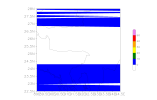
If i define desired lat-lon extent, then i get some horizontal bars in the plot. Please see attached test-plot.png
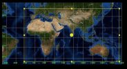
Domain picture & test.ctl are attached. How do I deal with this problem?
Thanks,


