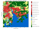
Hey could you resolve the issue ?
I am also getting the similar error :-
*************************************
Configuring physics suite 'conus'
mp_physics: 6* 6* 6*
cu_physics: 11* 11* 0*
ra_lw_physics: 1* 1* 1*
ra_sw_physics: 1* 1* 1*
bl_pbl_physics: 1* 1* 1*
sf_sfclay_physics: 1* 1* 1*
sf_surface_physics: 4* 4* 4*
(* = option overrides suite setting)
*************************************
Domain # 1: dx = 27000.000 m
Domain # 2: dx = 9000.000 m
Domain # 3: dx = 3000.000 m
WRF V4.5.2 MODEL
No git found or not a git repository, git commit version not available.
*************************************
Parent domain
ids,ide,jds,jde 1 137 1 130
ims,ime,jms,jme -4 53 -4 40
ips,ipe,jps,jpe 1 46 1 33
*************************************
DYNAMICS OPTION: Eulerian Mass Coordinate
alloc_space_field: domain 1 , 291936372 bytes allocated
med_initialdata_input: calling input_input
Input data is acceptable to use: wrfinput_d01
CURRENT DATE = 2019-05-08_00:00:00
SIMULATION START DATE = 2019-05-08_00:00:00
Timing for processing wrfinput file (stream 0) for domain 1: 1.56435 elapsed seconds
Max map factor in domain 1 = 1.04. Scale the dt in the model accordingly.
Climate GHG input from file from year 1765 to 2499
CO2 range = 277.91300000000001 579.26400000000001 ppm
N2O range = 274.37200000000001 359.79800000000000 ppb
CH4 range = 738.98599999999999 997.31100000000004 ppb
CFC11 range = 0.0000000000000000 1.4000000000000000E-002 ppt
CFC12 range = 0.0000000000000000 2.8809999999999998 ppt
Normal ending of CAMtr_volume_mixing_ratio file
GHG annual values from CAM trace gas file
Year = 2019 , Julian day = 128
CO2 = 4.1121466503504545E-004 volume mixing ratio
N2O = 3.3122485063326691E-007 volume mixing ratio
CH4 = 1.8981570152351642E-006 volume mixing ratio
CFC11 = 2.2122109117918800E-010 volume mixing ratio
CFC12 = 5.0012391132362750E-010 volume mixing ratio
INPUT LandUse = "MODIFIED_IGBP_MODIS_NOAH"
LANDUSE TYPE = "MODIFIED_IGBP_MODIS_NOAH" FOUND 61 CATEGORIES 2 SEASONS WATER CATEGORY = 17 SNOW CATEGORY = 15
Climatological albedo is used instead of table values
SOIL TEXTURE CLASSIFICATION = STAS FOUND 19 CATEGORIES
USING DEFAULT URBAN MORPHOLOGY
WARNING, FRC_URB2D = 0 BUT IVGTYP IS URBAN
WARNING, THE URBAN FRACTION WILL BE READ FROM URBPARM.TBL
USING DEFAULT URBAN MORPHOLOGY
WARNING, FRC_URB2D = 0 BUT IVGTYP IS URBAN
WARNING, THE URBAN FRACTION WILL BE READ FROM URBPARM.TBL
*************************************
Nesting domain
ids,ide,jds,jde 1 229 1 208
ims,ime,jms,jme -4 87 -4 63
ips,ipe,jps,jpe 1 76 1 52
INTERMEDIATE domain
ids,ide,jds,jde 29 110 29 103
ims,ime,jms,jme 24 65 24 57
ips,ipe,jps,jpe 27 55 27 47
*************************************
d01 2019-05-08_00:00:00 alloc_space_field: domain 2 , 10064544 bytes allocated
d01 2019-05-08_00:00:00 alloc_space_field: domain 2 , 689293592 bytes allocated
d01 2019-05-08_00:00:00 *** Initializing nest domain # 2 from an input file. ***
d01 2019-05-08_00:00:00 med_initialdata_input: calling input_input
d01 2019-05-08_00:00:00 Input data is acceptable to use: wrfinput_d02
Timing for processing wrfinput file (stream 0) for domain 2: 1.35691 elapsed seconds
Climate GHG input from file from year 1765 to 2499
CO2 range = 277.91300000000001 579.26400000000001 ppm
N2O range = 274.37200000000001 359.79800000000000 ppb
CH4 range = 738.98599999999999 997.31100000000004 ppb
CFC11 range = 0.0000000000000000 1.4000000000000000E-002 ppt
CFC12 range = 0.0000000000000000 2.8809999999999998 ppt
Normal ending of CAMtr_volume_mixing_ratio file
GHG annual values from CAM trace gas file
Year = 2019 , Julian day = 128
CO2 = 4.1121466503504545E-004 volume mixing ratio
N2O = 3.3122485063326691E-007 volume mixing ratio
CH4 = 1.8981570152351642E-006 volume mixing ratio
CFC11 = 2.2122109117918800E-010 volume mixing ratio
CFC12 = 5.0012391132362750E-010 volume mixing ratio
INPUT LandUse = "MODIFIED_IGBP_MODIS_NOAH"
LANDUSE TYPE = "MODIFIED_IGBP_MODIS_NOAH" FOUND 61 CATEGORIES 2 SEASONS WATER CATEGORY = 17 SNOW CATEGORY = 15
Climatological albedo is used instead of table values
SOIL TEXTURE CLASSIFICATION = STAS FOUND 19 CATEGORIES
USING DEFAULT URBAN MORPHOLOGY
WARNING, FRC_URB2D = 0 BUT IVGTYP IS URBAN
WARNING, THE URBAN FRACTION WILL BE READ FROM URBPARM.TBL
USING DEFAULT URBAN MORPHOLOGY
WARNING, FRC_URB2D = 0 BUT IVGTYP IS URBAN
WARNING, THE URBAN FRACTION WILL BE READ FROM URBPARM.TBL
USING DEFAULT URBAN MORPHOLOGY
WARNING, FRC_URB2D = 0 BUT IVGTYP IS URBAN
WARNING, THE URBAN FRACTION WILL BE READ FROM URBPARM.TBL

