Scheduled Downtime
On Friday 21 April 2023 @ 5pm MT, this website will be down for maintenance and expected to return online the morning of 24 April 2023 at the latest

Questions about the irrigation module embedded in WRF/NOAH-MP model

noah_lover

New member
Hello,

Recently, I have been using the WRF 4.7.0 version (WPS 4.6.0, NOAH-MP 4.7.0). I want to simulate the flood irrigation amount, however, the simulated irrigation amount is zero. I am not sure where the problems lie.

Question 1:
Which variables are necessary to simulate the flood irrigation amount. I saw a reply shown below in the forum, IRFRACT, FIFRACT, SIFRACT and MIFRACT are used in Noah-mp dynamic irrigation scheme. In addition, CROPTYPE should be necessary? However, FIFRACT, SIFRACT, MIFRACT and CROPTYPE are all empty values in geo_em.d01.nc (processed by ./geogrid.exe command). The IRFRACT is normal. I checked the GEOGRID.TBL file, all the variables mentioned above are included in the GEOGRID.TBL, and the source data is available and the path is right. Why are these variables are empty values?
1752218010133.png

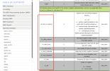
Question 2: In the Namelist Variables section of WRF users guide documentation (Namelist Variables — WRF Users Guide documentation), there are several irrigation-related variables. e.g. sf_surf_irr_scheme, irr_daily_amount.... Are these variables used with noah or noah_mp or both?
1752219183344.png
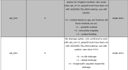
Besides, in %noah_mp part, there are also rrigation-related variables, e.g. opt_irr, opt_irrm. If I use the flood irrigation with noah_mp, which variables should I choose?
1752219357010.png
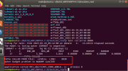
Last question, I run the ./wrf.exe, there occurs an error. It shows there is a water budget problem in NOAHMP GLACIER, how should I solve it? I run the wrf before and it runs successfully. I guess the reason might be that I changed some parameters。
1752219955753.png

Thanks for your reply! I am grateful for any suggestions.
 
attach the namelist.input and namelist.wps
 

Attachments

  • namelist.input
    4.5 KB · Views: 3
  • namelist.wps
    1,000 bytes · Views: 1
Please see my answers below:
Hello,

Recently, I have been using the WRF 4.7.0 version (WPS 4.6.0, NOAH-MP 4.7.0). I want to simulate the flood irrigation amount, however, the simulated irrigation amount is zero. I am not sure where the problems lie.

Question 1: Which variables are necessary to simulate the flood irrigation amount. I saw a reply shown below in the forum, IRFRACT, FIFRACT, SIFRACT and MIFRACT are used in Noah-mp dynamic irrigation scheme. In addition, CROPTYPE should be necessary? However, FIFRACT, SIFRACT, MIFRACT and CROPTYPE are all empty values in geo_em.d01.nc (processed by ./geogrid.exe command). The IRFRACT is normal. I checked the GEOGRID.TBL file, all the variables mentioned above are included in the GEOGRID.TBL, and the source data is available and the path is right. Why are these variables are empty values?

The following variables are related to flood irrigation:

"FIFRACT" "Flood Irrigation fraction"

"IRNUMFI" "Flood Irrigation Event Count"

"IRWATFI" "Flood Irrigation Amount for the Event"

"IRFIVOL" "Flood Irrigation Water Accumulated"

Besides, the following namelist options should be set:

opt_irr must be set (can be 1, 2, or 3)

opt_irrm = 3

CROPTYPE is not required.

When running geogrid.exe, GEOGRID.TBL must be linked to GEOGRID.TBL.ARW.noahmp


View attachment 18486

Question 2: In the Namelist Variables section of WRF users guide documentation (Namelist Variables — WRF Users Guide documentation), there are several irrigation-related variables. e.g. sf_surf_irr_scheme, irr_daily_amount.... Are these variables used with noah or noah_mp or both?
sf_surf_irr_scheme is an option independent of LSM. It can be used with either noah or noahmp.
irr_daily_amount is used when sf_surf_irr_scheme is turned on.
View attachment 18487
Besides, in %noah_mp part, there are also rrigation-related variables, e.g. opt_irr, opt_irrm. If I use the flood irrigation with noah_mp, which variables should

Please see my answers to your question (1).
View attachment 18488
Last question, I run the ./wrf.exe, there occurs an error. It shows there is a water budget problem in NOAHMP GLACIER, how should I solve it? I run the wrf before and it runs successfully. I guess the reason might be that I changed some parameters。
I don't have an immdeiate answer to this question. Debugging is needed to figure out what is wrong ....
View attachment 18489

Thanks for your reply! I am grateful for any suggestions.
 
The following variables are related to flood irrigation:

"FIFRACT" "Flood Irrigation fraction"

"IRNUMFI" "Flood Irrigation Event Count"

"IRWATFI" "Flood Irrigation Amount for the Event"

"IRFIVOL" "Flood Irrigation Water Accumulated"

Besides, the following namelist options should be set:

opt_irr must be set (can be 1, 2, or 3)

opt_irrm = 3

CROPTYPE is not required.

When running geogrid.exe, GEOGRID.TBL must be linked to GEOGRID.TBL.ARW.noahmp
Hi, Dr Chen,

I am sorry for the slow reply and grateful for your reply, but I still have some questions...
(1) As you said, "FIFRACT" , "IRNUMFI" , "IRWATFI" ,"IRFIVOL" are related to flood irrigation. So, Must they be used in flood irrigation simulation or just options?
(2) Besides, what about IRFRACT? When is the IRFRACT used?
(3) FIFRACT, SIFRACT, MIFRACT and CROPTYPE in geo_em.d01.nc are all empty values, do you know why?
sf_surf_irr_scheme is an option independent of LSM. It can be used with either noah or noahmp.
irr_daily_amount is used when sf_surf_irr_scheme is turned on.
(3) what is the difference between sf_surf_irr_scheme and opt_irr? As you said, opt_irr and opt_irrm must be set, what about sf_surf_irr_scheme? When to use it? Should they be used at the same time?
1753697520332.png1753697551542.png
(4) If I want to run a flood irrigation simulation, could you recommend a simple parameter setting for irrigation simulation case, which could run successfully.

A lot of questions. Thanks for your reply:)
 
Please see the answers below:
Hi, Dr Chen,

I am sorry for the slow reply and grateful for your reply, but I still have some questions...
(1) As you said, "FIFRACT" , "IRNUMFI" , "IRWATFI" ,"IRFIVOL" are related to flood irrigation. So, Must they be used in flood irrigation simulation or just options?
These variables are optional and space is allocated for them only when the irrigation scheme is activated.
(2) Besides, what about IRFRACT? When is the IRFRACT used?

IRFRACT is Irrigation fraction.
(3) FIFRACT, SIFRACT, MIFRACT and CROPTYPE in geo_em.d01.nc are all empty values, do you know why?
A few possibilities:
(1) you run geogrid.exe but didn't use GEOGRID.TBL.ARW.noahmp
(2) you don't have input data required for irrigation, formexample flood_fra
(3) what is the difference between sf_surf_irr_scheme and opt_irr? As you said, opt_irr and opt_irrm must be set, what about sf_surf_irr_scheme? When to use it? Should they be used at the same time?
They represent two different irrigation schemes used in WRF. Please refer to literature for details of these schemes.
View attachment 18619View attachment 18620
(4) If I want to run a flood irrigation simulation, could you recommend a simple parameter setting for irrigation simulation case, which could run successfully.
A lot of questions. Thanks for your reply:)
 
Please see the answers below:

These variables are optional and space is allocated for them only when the irrigation scheme is activated.


IRFRACT is Irrigation fraction.

A few possibilities:
(1) you run geogrid.exe but didn't use GEOGRID.TBL.ARW.noahmp
(2) you don't have input data required for irrigation, formexample flood_fra

They represent two different irrigation schemes used in WRF. Please refer to literature for details of these schemes.
Thanks a lot!
 
A few possibilities:
(1) you run geogrid.exe but didn't use GEOGRID.TBL.ARW.noahmp
(2) you don't have input data required for irrigation, formexample flood_fra
It seems the source data for flood_fract、micro_fract and sprinkler has only data over US. But the IRFRACT data is available over the globe
 
Hi,

I just double check WPS static data, ---- you are right these variables are only available over CONUS. It is not hard to create a similar dataset over the area you are interested, however, I suppose it is hard to determine the values of these variables.
 
Top