You are using an out of date browser. It may not display this or other websites correctly.
You should upgrade or use an alternative browser.
You should upgrade or use an alternative browser.
Running WPS with ERA5 input
- Thread starter koko_a
- Start date
-
- Tags
- input data
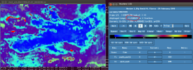
I think the points of negative vaules can not identified, because the resolution of pixel is so high about 5 km. However, I can check the ERA5 data for its soil data to check if exist negative values.Can you identify the points where soil moisture is negative? And what are the landuse type at these points? Do the negative soil data exist in original ERA5 data?
error while running ungrib.exe
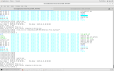
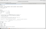
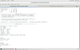
ihave attached the screen shot of namelist.wps and data the dates are correct and i have linked the Vtable of Era_intrim_pl
ihave attached the screen shot of namelist.wps and data the dates are correct and i have linked the Vtable of Era_intrim_pl
Attachments
Thanks for the link Ming. But could you or anyone else tell me if I need monthly ERA5 data for monthly simulations? Or I could still use the daily ERA5 data for the monthly simulations. Thanks.Please see the attached file that describes how to download ERA5 data. Hope this is helpful for you.
Please download ERA5 data at 6-hour intervals. This is because WRF lateral boundary needs to be updated as frequently as possible.
Even if you are running WRF for long-term simulation, e.g., monthly, seasonal or multi-year, you still need 6-hour interval data to update the lateral boundary.
Even if you are running WRF for long-term simulation, e.g., monthly, seasonal or multi-year, you still need 6-hour interval data to update the lateral boundary.
Thank you Ming. This is very helpful.Please download ERA5 data at 6-hour intervals. This is because WRF lateral boundary needs to be updated as frequently as possible.
Even if you are running WRF for long-term simulation, e.g., monthly, seasonal or multi-year, you still need 6-hour interval data to update the lateral boundary.
Hi Ming Chen,Surface boundary data (soil moisture, soil temperature, surface pressure, etc. ) are provided hourly.
is possible to get ERA5 data to run WRF at real time (for operational purpose) instead of the reanalysis data?
D
Deleted member 3607
Guest
Just wanted to let you know those instructions are dated now. @sadya_islam20 as the RDA server doesn't do a subset for grb anymore.See the attachment. Hope this will help to download the data.
Hi, sadya! I am also linking like the way you did. Can I ask how you link landsea_mask and geopotential.grib data ? or other invariable?As we need both to run simulation with ERA5 data, (1 ERA5 atmospheric pressure level analysis, 2 ERA5 atmospheric surface analysis),
I downloaded both of these data into a same folder and linked them in my WPS folder with this line:
./link_grib.csh /"your folder path"/e5.*
sadya_islam20
Member
Hi, sadya! I am also linking like the way you did. Can I ask how you link landsea_mask and geopotential.grib data ? or other invariable?
Hello Yiping,
I just used the ERA5 data; I did not use any other. But I use era5_invariant data that I download in the same folder as the pressure and surface data.
./link_grib.csh /"your folder path"/e5.* this command also connects invariant data into the WPS folder. Then you need to specify this in the namelist.wps in the &metgrid section:
constants_name = 'ERA5_INVARIANT',
Thank you very much for your answer. I already downloaded the invariables in my surface data, so I think there is no point to link the invariables separately?Hello Yiping,
I just used the ERA5 data; I did not use any other. But I use era5_invariant data that I download in the same folder as the pressure and surface data.
./link_grib.csh /"your folder path"/e5.* this command also connects invariant data into the WPS folder. Then you need to specify this in the namelist.wps in the &metgrid section:
constants_name = 'ERA5_INVARIANT',
sadya_islam20
Member
You do not need to, I guess. You can keep everything in the same folder and connect them using the above mentioned command.
Thank you very much for you answer! I think I did not clarify it clearly. Could you kindly see the code I provided to download data? I then use this command. ./link_grib.csh /nuist/scratch/zxf000337/yuyp/run_test/2010091003-2010091014/*You do not need to, I guess. You can keep everything in the same folder and connect them using the above mentioned command.
So I did not separate my variables and invariables because they all exist in the pressure data and surface data. You could see the landsea mask in my surface data which is invariables but I didnt separate it. I am not sure if this is the correct way to do so

