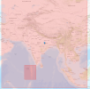
GFS data : 0.25 deg, dx : 6000 m. Timestep : 24s
I followed the instructions as in the links to adjust the dx accordingly: [Wrf-users] grid ratio & map factor and
Questions about time step
Previously, with the same namelists but with GFS data having 12 km instead of 0.25deg (~27 km), the wrf run was successful.
But after using the new gfs data of 0.25 deg (met_em files, wrfbdy_d01 file, and wrfinput_d0are successfully created), the wrf run stops with "Max map factor in domain 1 = 1.52. Scale the dt in the model accordingly.
D01: Time step = 24.0000000 (s)
D01: Grid Distance = 6.00000000 (km)
D01: Grid Distance Ratio dt/dx = 4.00000000 (s/km)
D01: Ratio Including Maximum Map Factor = 6.09976149 (s/km)
D01: NML defined reasonable_time_step_ratio = 6.00000000 "
I have tried with dx :3000, 3500, 4000, 5000 m and with adjusted timesteps. But still unsuceesful while running wrf.exe.
It will be a great help if anyone would look into it.
Thanks in advance.
Attachments
Last edited:

