RSAPIAIN_DMC
Member
Good morning from Chile.
I would like your assistance with this; using WPS4.1; I'm a computer specialist, and not an Earth-science minor/major, so I'm a bit in the dark regarding this.
We are trying ro create a set of nested domains for Antarctic continent (Antarctica/Antarctica); I'm also aware of the need to remove the 'search' from the GREENFRAC in GEOGRID.TBL, detailed here.
The little documentation that we have, states that we need to:
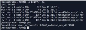
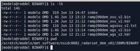
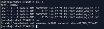
1.- Download the DEM / RAMP data from ftp://sidads.colorado.edu/pub/DATASETS/nsidc0082_radarsat_dem_v02
There is 1km, 400m, and 200km data, in different formats and projections: Polar-WGS and OSU.
2.- Create an index file that should look like: (the docs stated the -91.0, which I think is not correct)
3.- Modify the GEOGRID.TBL, changing the HGT_M section to this:
(currently for all other domains in Continental Chile it uses 'topo_gmted2010_30s')
What I don´t know, and request help/clarifications:
Thank you in advance for the help.
I would like your assistance with this; using WPS4.1; I'm a computer specialist, and not an Earth-science minor/major, so I'm a bit in the dark regarding this.
We are trying ro create a set of nested domains for Antarctic continent (Antarctica/Antarctica); I'm also aware of the need to remove the 'search' from the GREENFRAC in GEOGRID.TBL, detailed here.
The little documentation that we have, states that we need to:
1.- Download the DEM / RAMP data from ftp://sidads.colorado.edu/pub/DATASETS/nsidc0082_radarsat_dem_v02
There is 1km, 400m, and 200km data, in different formats and projections: Polar-WGS and OSU.
2.- Create an index file that should look like: (the docs stated the -91.0, which I think is not correct)
type=continuoussigned=yesprojection=polar_wgs84#projection=polardx=1000.dy=1000.known_x=2868.0known_y=2458.0known_lat=-90.0known_lon=0.0wordsize=2truelat1=-71.0truelat2=-90.0#truelat2=-91.0 ## this was an example we had... I think this value is not correctstdlon =0.0tile_x=1434tile_y=1229tile_z=1tile_bdr=100units="metersMSL""description="Topography height"3.- Modify the GEOGRID.TBL, changing the HGT_M section to this:
name = HGT_M priority = 2 dest_type = continuous smooth_option = smth-desmth_special; smooth_passes=1 fill_missing=0. interp_option = ramp1km:average_gcell(4.0)+four_pt interp_option = ramp400m:average_gcell(4.0)+four_pt interp_option = ramp200m:average_gcell(4.0)+four_pt interp_option = default:average_gcell(4.0)+four_pt rel_path= ramp1km:ramp1km/ rel_path= ramp400m:ramp400m/ rel_path= ramp200m:ramp200m/ rel_path= default:ramp200m/(currently for all other domains in Continental Chile it uses 'topo_gmted2010_30s')
What I don´t know, and request help/clarifications:
- The index file should be different for each value-set (1km, 400m, 200m)?
- How do I calculate the correct values for each set?
- Is it the same for binary/arcinfo, or we only need the binary files for running WPS in Antarctica ?
- For the WPS, which should I use, the binary data?
- In the case of the geog_v4 data, the files/folders have an index file, and then some other data files with numbers on their name.
- Do we have to convert the DEM .bin/.hdr files to that format, or just creating the index file should do the trick?
- Is there a correct and hopefully automated way to create/define the index file and/or perform the conversion?
Thank you in advance for the help.
")
 , i'm basically creating the documentation...).