Hi All,
I'm trying to use Gao's 2020 SSP5 urban fraction data (https://dataverse.harvard.edu/file.xhtml?persistentId=doi:10.7910/DVN/85PJ1D/N3Y1JC&version=1.0) in WRF.
I followed the User Guide to convert TIFF to BIL format and make WRF-ready files (Chapter 3: WRF Standard Initialization), but geogrid.exe isn't creating FRC_URB2D (all zeros in output).
Steps I did:
Attached: TIFF, BIL, HDR, and WRF-ready files.
Thanks for your help!
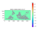
I'm trying to use Gao's 2020 SSP5 urban fraction data (https://dataverse.harvard.edu/file.xhtml?persistentId=doi:10.7910/DVN/85PJ1D/N3Y1JC&version=1.0) in WRF.
I followed the User Guide to convert TIFF to BIL format and make WRF-ready files (Chapter 3: WRF Standard Initialization), but geogrid.exe isn't creating FRC_URB2D (all zeros in output).
Steps I did:
- Converted TIFF to BIL:
gdal_translate -of ENVI Gao_2020_ssp5_2050.tif Gao_2020_ssp5_2050.bil - Renamed to 00001-02880.00001-01117 (2880x1117 grid)
- Created index file based on .hdr file
- Why is geogrid.exe ignoring the urban fraction data?
- Could the index file format be incorrect?
Attached: TIFF, BIL, HDR, and WRF-ready files.
Thanks for your help!