Scheduled Downtime
On Friday 21 April 2023 @ 5pm MT, this website will be down for maintenance and expected to return online the morning of 24 April 2023 at the latest

Optional fields not processed by geogrid.

William.Hatheway

Active member
I'm using noahmp and I have downloaded all the geography files located at this website: Static Data Downloads

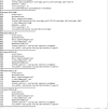
But I am getting this message when running geogrid:


Code:
Parsed 67 entries in GEOGRID.TBL
Processing domain 1 of 2
  Processing XLAT and XLONG
  Processing MAPFAC
  Processing F and E
  Processing ROTANG
  Processing LANDUSEF
  Calculating landmask from LANDUSEF ( WATER =  17  21 )
  Processing HGT_M
  Processing SOILTEMP
  Processing SOILCTOP
  Processing SCT_DOM
  Processing SOILCBOT
  Processing SCB_DOM
  Processing ALBEDO12M
  Processing GREENFRAC
  Processing LAI12M
  Processing SNOALB
  Processing CON
  Processing VAR
  Processing OA1
  Processing OA2
  Processing OA3
  Processing OA4
  Processing OL1
  Processing OL2
  Processing OL3
  Processing OL4
  Processing VAR_SSO
  Processing LAKE_DEPTH
  Processing URB_PARAM
  Processing FRC_URB2D
  Processing IMPERV
  Processing CANFRA
  Processing EROD
  Processing CLAYFRAC
  Processing SANDFRAC
  Processing IRRIGATION
  Processing CONLS
  Processing VARLS
  Processing OA1LS
  Processing OA2LS
  Processing OA3LS
  Processing OA4LS
  Processing OL1LS
  Processing OL2LS
  Processing OL3LS
  Processing OL4LS
  Processing CONSS
  Processing VARSS
  Processing OA1SS
  Processing OA2SS
  Processing OA3SS
  Processing OA4SS
  Processing OL1SS
  Processing OL2SS
  Processing OL3SS
  Processing OL4SS
  Processing CROPTYPE
  Processing SEASON_GDD
  Processing PLANTING
  Processing HARVEST
  Processing IRFRACT
  Processing SIFRACT
  Processing MIFRACT
  Processing FIFRACT
  Processing TD_FRACTION
  Processing FDEPTH
  Processing RECHCLIM
  Processing EQZWT
  Processing RIVERBED

  Optional fields not processed by geogrid:
    SOILCOMP (priority=1, resolution='', path='')
    SOILCL1F (priority=1, resolution='', path='')
    SOILCL2F (priority=1, resolution='', path='')
    SOILCL3F (priority=1, resolution='', path='')
    SOILCL4F (priority=1, resolution='', path='')

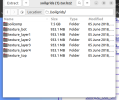
The optional fields don't appear in any of my tar files downloaded for static data. Is this user defined?
 
Take a look at this previous post, which discusses this issue (for a different variable, but the same issue).

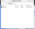
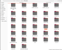
So I think the issue is the geogrid file for noahmp. The files are downloaded and properly extracted into my geog folder.

However if you look at the geogrid table for noahmp you can see that it has different rel_path compared to the others.

for example:


Code:
===============================
name=EQZWT
        priority=1
        optional=yes
        dest_type=continuous
        interp_option=default:average_gcell(1.0)+average_4pt+search
        masked = water
        fill_missing = 0.
        rel_path=default:groundwater/wtd/
===============================
name=RIVERBED
        priority=1
        optional=yes
        dest_type=continuous
        interp_option=default:average_gcell(1.0)+average_4pt+search
        masked = water
        fill_missing = 0.
        rel_path=default:groundwater/riverbed/


Code:
===============================
name=SOILCOMP
        priority=1
        optional=yes
        dest_type=continuous
        interp_option=soilgrids:average_gcell(0.0)+average_4pt+average_16pt
        z_dim_name=soilcomp
        masked = water
        fill_missing = 0.
        rel_path=soilgrids:soilgrids/soilcomp/
===============================
name=SOILCL1F
        priority=1
        optional=yes
        dest_type=categorical
        z_dim_name=soil_cat
        dominant=SOILCL1
        interp_option = soilgrids:nearest_neighbor
        rel_path= soilgrids:soilgrids/texture_layer1/
===============================
name=SOILCL2F
        priority=1
        optional=yes
        dest_type=categorical
        z_dim_name=soil_cat
        dominant=SOILCL2
        interp_option = soilgrids:nearest_neighbor
        rel_path= soilgrids:soilgrids/texture_layer2/
===============================
name=SOILCL3F
        priority=1
        optional=yes
        dest_type=categorical
        z_dim_name=soil_cat
        dominant=SOILCL3
        interp_option = soilgrids:nearest_neighbor
        rel_path= soilgrids:soilgrids/texture_layer3/
===============================
name=SOILCL4F
        priority=1
        optional=yes
        dest_type=categorical
        z_dim_name=soil_cat
        dominant=SOILCL4
        interp_option = soilgrids:nearest_neighbor
        rel_path= soilgrids:soilgrids/texture_layer4/
===============================

Is this a bug or just something that needs to be added to the namelist.wps file to activate the geogrid files?

Was discussed on github

and a PR was issued.

Guess it just got busy there and hasn't been implemented?
 

Attachments

  • Screenshot from 2024-04-16 07-05-44.png
    Screenshot from 2024-04-16 07-05-44.png
    32 KB · Views: 1
  • Screenshot from 2024-04-16 07-06-52.png
    Screenshot from 2024-04-16 07-06-52.png
    72.8 KB · Views: 1
  • Screenshot from 2024-04-16 07-06-49.png
    Screenshot from 2024-04-16 07-06-49.png
    149.1 KB · Views: 1
  • Screenshot from 2024-04-16 07-12-38.png
    Screenshot from 2024-04-16 07-12-38.png
    376.1 KB · Views: 1
  • Screenshot from 2024-04-16 07-05-48.png
    Screenshot from 2024-04-16 07-05-48.png
    75.1 KB · Views: 1
If you wanted to use these data, you would need to set geog_data_res = 'soilgrids+default' for each domain, and you'd need to link the
GEOGRID.TBL.ARW.noahmp file to GEOGRID.TBL, since that's the name the geogrid program looks for.
 
Top